Runavík Municipality

Runavík Municipality lies on Eysturoy, the second-largest island of the Faroe Islands, and is built around Skálafjørður, the longest fjord in the country. Its 15 villages range from the almost continuous settlement of Saltangará, Runavík, Glyvrar and Skála along the fjord to small, more remote villages such as Funningur, Elduvík and Æðuvík. Saltangará is the administrative centre, and Runavík is the third-largest municipality in the Faroe Islands. Since  Eysturoyartunnilin, the subsea tunnel, opened in 2020, Runavík has been a short drive from the capital, Tórshavn, which has strengthened the municipality's role as a place to live and work in the central Faroes.

The Faroe Islands are a self-governing nation within the Kingdom of Denmark, with their own parliament and government responsible for most domestic affairs, including fisheries and the environment. The islands are not part of the European Union.
Ecological Characteristics

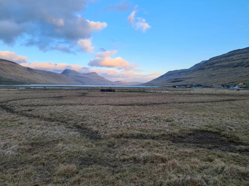
The Faroe Islands are an isolated, volcanic archipelago in the North Atlantic with a cool, humid and windy oceanic climate. The landscape is largely treeless and dominated by grassland, heath and mires, shaped over centuries by sheep grazing and the traditional division between cultivated infield (bøur) close to the villages and common grazing land in the outfield (hagi). Terrestrial species diversity is relatively low, while seabird colonies and marine ecosystems are of international importance.

In Runavík, the sheltered waters of Skálafjørður contrast with the exposed coasts of eastern and northern Eysturoy. The fjord is the setting for the municipality's main harbour, while its shallow shores and inner reaches are feeding grounds for waders, eiders and other coastal birds. 

Runavík Municipality

Salmon farming takes place in other fjords in the municipality, but not in Skálafjørður, where oxygen levels and currents are too low. Around the fjord, the landscape rises through valleys, streams and small lakes to steep mountains, and the outer coasts are marked by sea cliffs with breeding seabirds.

Growth along the fjord brings the relationship between settlement, harbour activity and nature into focus. The municipality is working to strengthen the natural values of Skálafjørður and to make nature a more visible part of planning and everyday life.

Socio-Economics Characteristics

Faroese is the main language, and Danish is widely understood and used. The local economy has strong maritime roots: the harbour on Skálafjørður is a hub for fishing, shipping and maritime services, and salmon farming and its onshore industry are important employers, complemented by public services, retail, trades and small businesses. The improved road connections have made the municipality an attractive place to live for people working elsewhere in the central Faroes, and the population is growing.

Community life is organised around the individual villages, each of which has its own village committee that represents residents and contributes to municipal life. Cultural heritage is closely tied to the landscape: Funningur is, according to legend, one of the first places in the Faroe Islands to be settled, and its turf-roofed wooden church is among the best-known in the country. Outdoor life, including hiking, sailing and traditional Faroese rowing, is an important part of local identity.

Key Data

Country: Faroe Islands
Area: Approx. 100 km²
Population: Approx. 4,435 inhabitants
Villages: 15
Administrative centre: Saltangará